Creating Orthomosaic Using Drone Images
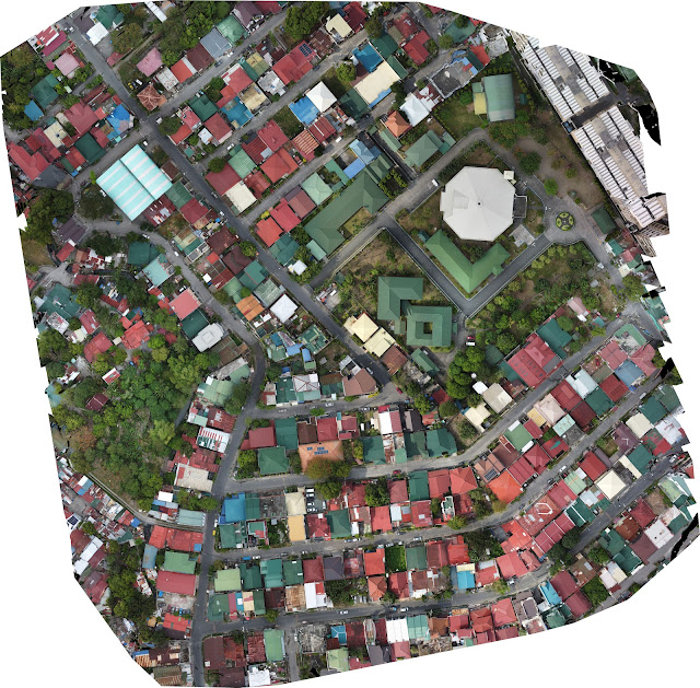
In this article we will create an orthomosaic using drone images which can be used as an aerial view map of an area you intend to capture. First of all, we need a drone that uses GNSS (Global Navigation Satellite System) for the aerial survey. You can use most DJI drones depending on the mapping apps that you're going to use. Here are the mobile apps which can be used for mapping: - DJI GS Pro - Pix4D - Map Pilot Pro - Drone Deploy - UGCS - DJI Pilot 2 These are the common settings which we can find in mapping apps: GSD : also known as Ground Sample Distance is usually measured in cm/pixel. Lower numbered GSD means better resolution and quality of images. Numbers less than 3cm/px are a good starting point. Also, flying height dictates the gsd resolution, higher altitude = high gsd. Flight Height or Altitude: This will determine the gsd of your project. 60-120m (200-400ft) should be goo...